Ngorongoro Conservation Area

Descend into the magnificent crater and discover one of Africa’s most remarkable wildlife sanctuaries.

Ngorongoro Crater Overview

The Ngorongoro Conservation Area (NCA) is one of Tanzania’s most remarkable protected landscapes, renowned for its extraordinary wildlife, breathtaking scenery, volcanic geology, archaeological importance, and rich cultural heritage. Located in northern Tanzania between Serengeti National Park and Lake Manyara National Park, the conservation area covers approximately 8,292 square kilometers (3,202 square miles).

It forms an important part of the Northern Safari Circuit and is often visited together with Tarangire National Park, Lake Manyara National Park, and Serengeti National Park.

Unlike a conventional national park, the Ngorongoro Conservation Area was established as a multiple-use landscape. Wildlife conservation, tourism, scientific research, and traditional pastoral activities take place within the same protected area. This makes the NCA one of the few places in the world where local communities continue to live alongside large populations of wild animals.

Established in 1959, the Ngorongoro Conservation Area was created to conserve wildlife while allowing the indigenous Maasai people to continue practicing their traditional pastoral lifestyle.

Today, it is recognized as a UNESCO World Heritage Site and an International Biosphere Reserve, reflecting its outstanding ecological, geological, archaeological, and cultural significance.

Location and Geography

The Ngorongoro Conservation Area lies about 180 kilometers (112 miles) west of Arusha and forms part of Tanzania’s famous Northern Safari Circuit. It is situated within the eastern branch of the Great Rift Valley, a major geological feature that stretches across eastern Africa. The area includes highland plateaus, volcanic mountains, deep valleys, open plains, forests, lakes, and wetlands.

The conservation area’s elevation varies considerably. The crater rim stands at approximately 2,200 meters (7,200 feet) above sea level, while the crater floor lies at roughly 1,800 meters (5,900 feet). This difference in altitude creates noticeable changes in temperature, vegetation, rainfall, and wildlife habitats.


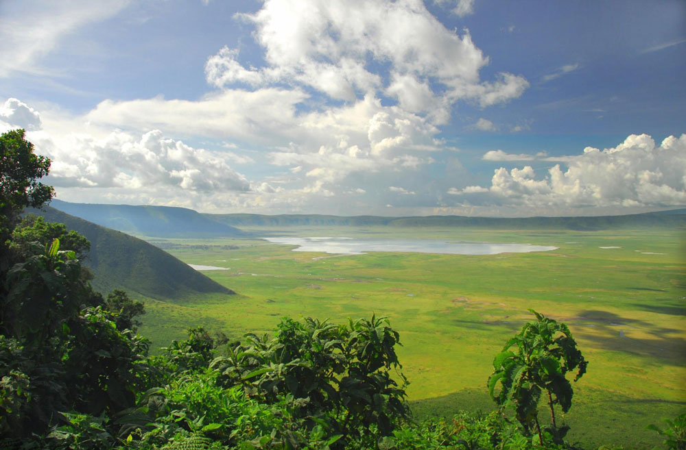
Its most famous landmark is the Ngorongoro Crater, the world’s largest intact and unfilled volcanic caldera. Formed approximately two to three million years ago after a massive volcano collapsed, the crater measures about 19 kilometers (12 miles) across and covers nearly 260 square kilometers (100 square miles). Its steep walls rise over 600 meters (2,000 feet) above the crater floor, creating a natural enclosure for an abundance of wildlife.

Geological and Volcanic Features

The landscape of the Ngorongoro Conservation Area was shaped by millions of years of volcanic activity, tectonic movement, erosion, and changing climate conditions. Several extinct volcanoes and volcanic peaks are found throughout the region, including Olmoti Crater, Empakaai Crater, and Mount Oldeani.

These volcanic formations have influenced the area’s soils and vegetation. Volcanic ash and mineral rich soils support productive grasslands, while underground springs and rainfall collect in crater basins and valleys. The region’s geological history also explains the presence of fertile grazing areas that attract both wildlife and pastoral communities.

Olmoti Crater is known for its green crater floor and waterfall, while Empakaai Crater contains a deep alkaline lake surrounded by forested slopes. These lesser known sites offer quieter hiking and scenic experiences away from the busier Ngorongoro Crater.

Ngorongoro Crater

The Ngorongoro Crater is often referred to as the “Eighth Wonder of the World” because of its spectacular scenery and remarkable concentration of wildlife. From the crater rim, visitors can see a vast green and golden landscape surrounded by steep walls, with animals appearing as small moving shapes across the floor.

The crater floor contains permanent water sources, fertile grasslands, swamps, forests, and seasonal streams that provide ideal conditions for animals throughout the year. Important areas include:

  • Lake Magadi, a shallow alkaline lake that attracts flamingos and other water birds.
  • Ngoitoktok Springs, a reliable water source where hippos and other animals are often seen.
  • Lerai Forest, a woodland area known for elephants and other forest species.
  • Open grasslands that support large herds of wildebeest, zebra, buffalo, and gazelles.
  • Marshes and wetlands that provide drinking water and grazing opportunities.

Wildlife in Ngorongoro Crater

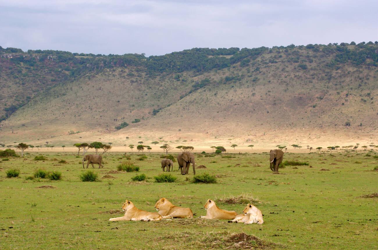
Ngorongoro Conservation Area supports an incredible diversity of wildlife, with more than 25,000 large animals living within the crater alone. The surrounding highlands and plains support additional populations that move seasonally in response to rainfall, grazing conditions, and water availability.

Visitors have excellent opportunities to see the famous Big Five:

  • Lion
  • Leopard
  • African Elephant
  • African Buffalo
  • Black Rhinoceros

The area is one of the best places in Tanzania to observe the endangered black rhinoceros, thanks to intensive conservation efforts and careful monitoring. Rhinos are often seen grazing in the open grasslands, although sightings are never guaranteed because they are naturally cautious and may remain far from roads.

Lions are commonly observed in the crater, where they hunt wildebeest, zebra, buffalo, and other grazing animals. Spotted hyenas are also abundant and may be seen near water sources or moving across the plains. Leopards are more secretive and are usually found in woodland areas, particularly around Lerai Forest.

Other commonly seen animals include:

  • Wildebeest
  • Plains zebra
  • Thomson’s gazelle
  • Grant’s gazelle
  • Eland
  • Hartebeest
  • Waterbuck
  • Warthog
  • Hippopotamus

The Maasai People

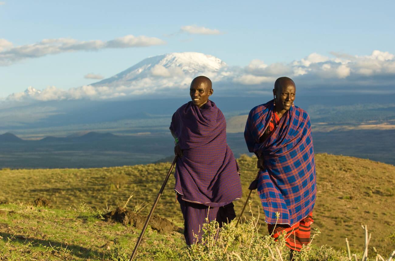
One of the unique characteristics of the Ngorongoro Conservation Area is the continued presence of the Maasai people. Unlike most national parks, the conservation area allows Maasai communities to live within its boundaries while maintaining their traditional pastoral lifestyle.

Maasai families traditionally depend on cattle, goats, and sheep for food, income, cultural identity, and social status. Livestock are moved between grazing areas according to seasonal rainfall and water availability. Many communities also cultivate limited crops in suitable areas, although pastoralism remains central to their way of life.

Visitors can learn about Maasai culture through guided village visits, where they may experience traditional dances, crafts, livestock keeping, house construction, beadwork, and local customs. Some cultural tours also explain the importance of cattle, age-set systems, ceremonies, family structures, and traditional environmental knowledge.

Olduvai Gorge " The Craddle Of Humankind"

Located within the conservation area, Olduvai Gorge is one of the world’s most important archaeological sites. The gorge is a steep-sided ravine extending for approximately 48 kilometers through the eastern Serengeti plains. Its exposed geological layers preserve evidence of ancient environments and human activity over millions of years.

Fossils discovered here by Louis and Mary Leakey provided groundbreaking evidence about early human evolution. The site contains ancient stone tools, fossil remains, animal bones, and footprints that help scientists understand how early human ancestors lived, moved, hunted, and adapted to changing environments.

Olduvai Gorge is often referred to as the “Cradle of Mankind,” although human evolution occurred across many parts of Africa. The site’s importance comes from the exceptional concentration and preservation of archaeological evidence.

The Olduvai Gorge Museum displays fossils, tools, maps, photographs, and explanations of the area’s geological and archaeological history. Visitors can learn how researchers identify different layers of sediment and use them to reconstruct ancient landscapes.

Laetoli Footprints

Another important archaeological site in the wider Ngorongoro Conservation Area is Laetoli, where fossilized footprints of early hominins were discovered in volcanic ash. The footprints are approximately 3.6 million years old and provide evidence that early human ancestors walked upright.

The footprints were preserved when volcanic ash hardened after rainfall, creating a natural record of movement across the ancient landscape. They are among the most significant discoveries in the study of human evolution because they demonstrate bipedal walking long before the development of modern humans.

Access to archaeological sites may be restricted to protect them from erosion, weather, and human disturbance. Visitors should follow official guidance and avoid touching or walking on protected remains.

Climate

The Ngorongoro Conservation Area enjoys a mild climate due to its high elevation, although conditions vary significantly between the crater rim, crater floor, forests, and lower plains.

Typical weather patterns include:

  • Cool mornings and evenings throughout the year.
  • Warm daytime temperatures.
  • Long rains from March to May.
  • Short rains during November and December.
  • Dry season from June to October.
  • Occasional mist and cloud cover along the crater rim.
  • Warmer conditions on the crater floor than on the rim.

Temperatures near the crater rim are generally cooler than those on the crater floor, so visitors should carry warm clothing, especially for early morning game drives. A fleece jacket, waterproof layer, comfortable walking shoes, sun protection, and insect repellent are useful throughout the year.

Rainfall can affect road conditions, particularly on steep crater access routes and unpaved roads. During the wet season, some roads may become muddy, although the rains also create beautiful green scenery and improve wildlife habitat.

Best Time to Visit Ngorongoro

The Ngorongoro Conservation Area can be visited throughout the year, but the best time depends on the visitor’s interests.

  • June to October: Excellent wildlife viewing during the dry season. Vegetation is shorter, animals gather around permanent water sources, and roads are generally easier to travel. Mornings can be cold, especially on the crater rim.
  • November to February: Green landscapes, pleasant temperatures, and excellent birdwatching. Migratory birds are present, and the surrounding plains may support large herds.
  • January to March: Opportunity to combine a visit with the wildebeest calving season in the nearby southern Serengeti. This period offers dramatic predator activity and excellent photography.
  • March to May: Lush scenery, fewer tourists, and lower accommodation rates in some areas. Heavy rainfall may occasionally affect road conditions and visibility.
  • December holidays and July to October: These periods can be busy, so advance booking is recommended for lodges, camps, permits, and transport.

The crater itself can be rewarding at any time of year because permanent water and resident wildlife remain available even when seasonal conditions change.

Interesting Facts about Ngorongoro Crater

  • Ngorongoro Crater is the world’s largest intact volcanic caldera.
  • The conservation area covers over 8,000 square kilometers.
  • More than 25,000 large animals live within the crater.
  • The area is one of the best places in Africa to see black rhinos.
  • Over 500 bird species have been recorded.
  • The Maasai people continue to live within the conservation area.
  • Olduvai Gorge is one of the world’s most important archaeological sites.
  • Laetoli preserves ancient hominin footprints dating back approximately 3.6 million years.
  • The crater floor contains grasslands, forests, wetlands, springs, and an alkaline lake.
  • The conservation area is both a UNESCO World Heritage Site and an International Biosphere Reserve.
  • Volcanic soils contribute to the productivity of the surrounding grasslands.
  • The Ngorongoro ecosystem is connected to the wider Serengeti migration system.
  • The crater rim is significantly cooler than the crater floor.
  • The area supports both wildlife conservation and traditional pastoral livelihoods.
  • Several smaller volcanic craters and highland landscapes can be explored outside the main crater.

Start Planning Your Dream Trip with Us!

Booking form

Everything You Need to Know About Your Safari

Planning Your Safari? Find Your Answers Here

Start Planning Your Dream Trip with Us!

What is the Ngorongoro Conservation Area famous for?

The Ngorongoro Conservation Area is best known for the Ngorongoro Crater, the world’s largest intact volcanic caldera. It is also famous for its exceptional wildlife, including the Big Five, its Maasai cultural heritage, and important archaeological sites such as Olduvai Gorge.

Yes. The Ngorongoro Conservation Area is one of the best places in Tanzania to see the Big Five lion, leopard, African elephant, African buffalo, and the endangered black rhinoceros. The crater’s enclosed ecosystem provides excellent wildlife viewing throughout the year.

The conservation area is open year-round. The dry season, from June to October, offers excellent game viewing, while November to February features lush landscapes and outstanding birdwatching. January to March is also a great time to combine a visit with the wildebeest calving season in the nearby southern Serengeti.

Most visitors spend one full day exploring the Ngorongoro Crater. However, a stay of 2 to 3 days is recommended if you want to include cultural visits to Maasai communities, hiking in the highlands, or excursions to Olduvai Gorge and other attractions within the conservation area.

The Ngorongoro Conservation Area is approximately 180 kilometers (112 miles) from Arusha and can be reached by road in about four to five hours. Visitors can also fly to nearby airstrips from Arusha, Dar es Salaam, Zanzibar, or Serengeti, followed by a short road transfer to the conservation area.